BUCHANAN DAM, Texas
Pronounced: "Buch-an-ann" (rhymes with "buck"
deer, with the "k" not emphasized)
"no slogan"
Population (2007): 1,814 Businesses
(2000):
 COL Index (2008): 83.6
Elevation: 1,043 ft Area: 20.1 sm
 County: Llano
Zip Code: 78609 Area Code: 512
 Time Zone: CST
Coordinates: 30 45' 52" N, 98 27' 15" W
Location: On S shore of Lake Buchanan; 71 mi NW of Austin
16 mi E of Llano; 13 mi W of Burnet; 8 mi N of Kingsland; 9 mi SE of Bluffton
Highways: TX 29, RR 261
Creeks: Rivers: Colorado
 Lakes: Buchanan, Inks
Parks: Nearby Inks Lake State Park, Black Rock
REFERENCES
CITY: Unincorporated, Census Designated Place (CDP)
CHAMBER & TOURISM:
LAKE BUCHANAN/INKS LAKE CHAMBER OF COMMERCE:
512-793-2803; Fax: 512-793-2112
PO Box 282, Buchanan Dam, TX 78609
Web: www.buchanan-inks.org;
E-mail: info@buchanan-inks.com 
HILL COUNTRY ECONOMIC DEVELOPMENT COUNCIL:
830-798-8118
608 Gateway Central, Suite 101, Marble Falls, TX 78654
Web: www.hillcountryedc.com;
Email: not available
HCEDC serves: Burnet and Llano Counties, focusing on the Highland Lakes area above Austin,
including Bertram, Buchanan Dam, Burnet, Cottonwood Shores, Granite Shoals, Highland
Haven, Horseshoe Bay, Kingsland, Llano, Marble Falls, Meadowlakes, Spicewood, Sunrise
Beach
MAJOR ATTRACTIONS: Lake Buchanan, Inks Lake State Park 
BUCHANAN DAM: Built by the LCRA in 1939, it is the largest multi-arch dam in the world.
Open for visitor viewing. See museum and visitor center below. Part of Highland Lakes area
(see Highland Lakes)
BUCHANAN DAM & MUSEUM & VISITOR CENTER: 512-793-2803. W. Hwy 29, Buchanan Dam
(SH 29 West of Inks Lake Bridge). Spectacular view of largest of Highland Lakes; in
building near dam; telescopes. Houses local chamber of commerce, and museum that features
construction of Buchanan Dam, dedicated in 1937 and one of the largest of its kind in the
U.S. Living history videotape, old photographs, exhibits on area history, Xeriscape
garden. Visitors enjoy feeding huge school of fish that congregate below observation deck.
Dam is open year round. Visitor Center open seasonally. Free Admission. Daily 9a-5p
(closed holidays). Map 
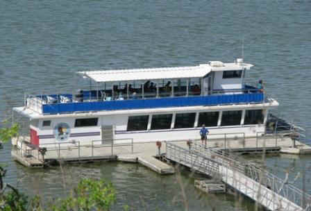
VANISHING TEXAS RIVER CRUISE: 800-474-8374; Originates at N end of Lake Buchanan where
tour boat docks at Canyon of the Eagles Park pier (see below). This 2.5 hr tour in an
enclosed boat with 2 observation decks allows visitors to see the spectacular wilderness
and wildlife (including eagles) along the Canyon of the Colorado River that feeds into the
lake. www.vtrc.com
CANYON OF THE EAGLES LODGE & NATURE PARK: 800-977-0081; 16942 RR 2341, Burnet (postal
address, but actually much closer to Buchanan Dam). Eagle Eye observatory. Home of
Vanishing Texas River Cruise. Conference Center, restaurant, lodging, camping and RV
facilities. www.canyonoftheeagles.com;
and Highland Lakes 
PARKS: See Parks
Lower Colorado River Authority (LCRA) and state parks in the region. See: Canyon of the
Eagles, Black Rock LCRA, Cedar Point LCRA, Inks Lake State Park, and more.
EVENT CALENDAR: See web site shown above.
WEATHER: Weather Underground (Burnet)
MEDIA COVERAGE: Latest News (Topix)
Newspaper:
MAPS: Google, GeoHack
PRINCIPAL BUSINESS: Lake recreation, retirement living
HISTORY: Handbook Of Texas Online: "It was initially the site of a
construction camp established to build the first of the major flood-control and
power-generation facilities on the Colorado River. The project was originally known as
Bluffton Dam for the nearby town of Bluffton, but the name was changed to Hamilton Dam,
perhaps because its location had been surveyed in 1926 by an engineer named Hamilton. Some
say it was named after G. W. Hamilton, vice president of the Middle West Utility Company
of Chicago, a company that represented the Insul interests active in developing electrical
power distribution in Texas. The Emery-Peck and Rockwood Development Company undertook the
construction of the dam in 1931 and established a post office and a settlement of several
hundred workers supported by commercial, medical, and recreational facilities. In 1932
bankruptcy forced the closing of the project. United States Congressman James Paul
Buchanan secured federal funds to revive the project in 1934, whereupon the dam, post
office, and town were renamed in his honor. The dam was dedicated on October 16, 1937. The
town grew steadily as a recreational center, reaching a population of over 1,000 in 1974,
when it had numerous businesses. In 1990 the population was 1,099, and in 2000 it had
grown to 1,688."

